Building Density, Not Trees, Was Strongest Predictor of Home Loss in Los Angeles Firestorms, Finds New Cal Poly Study

Contact: Reed Kenny | 707-601-1596, rekenny@calpoly.edu
Research by Cal Poly and Urban Forest Institute scientists challenges assumptions about urban trees fueling wildfire destruction from the deadly 2025 Eaton and Palisades fires; study suggests policymakers should be cautious about removing valuable urban canopy without stronger evidence that trees are major drivers of home destruction in dense urban firestorms
SAN LUIS OBISPO, Calif. — A new peer-reviewed study by Cal Poly faculty and scientists found that building density, not urban trees, was the strongest predictor of whether homes were destroyed during the catastrophic Southern California firestorms of January 2025.
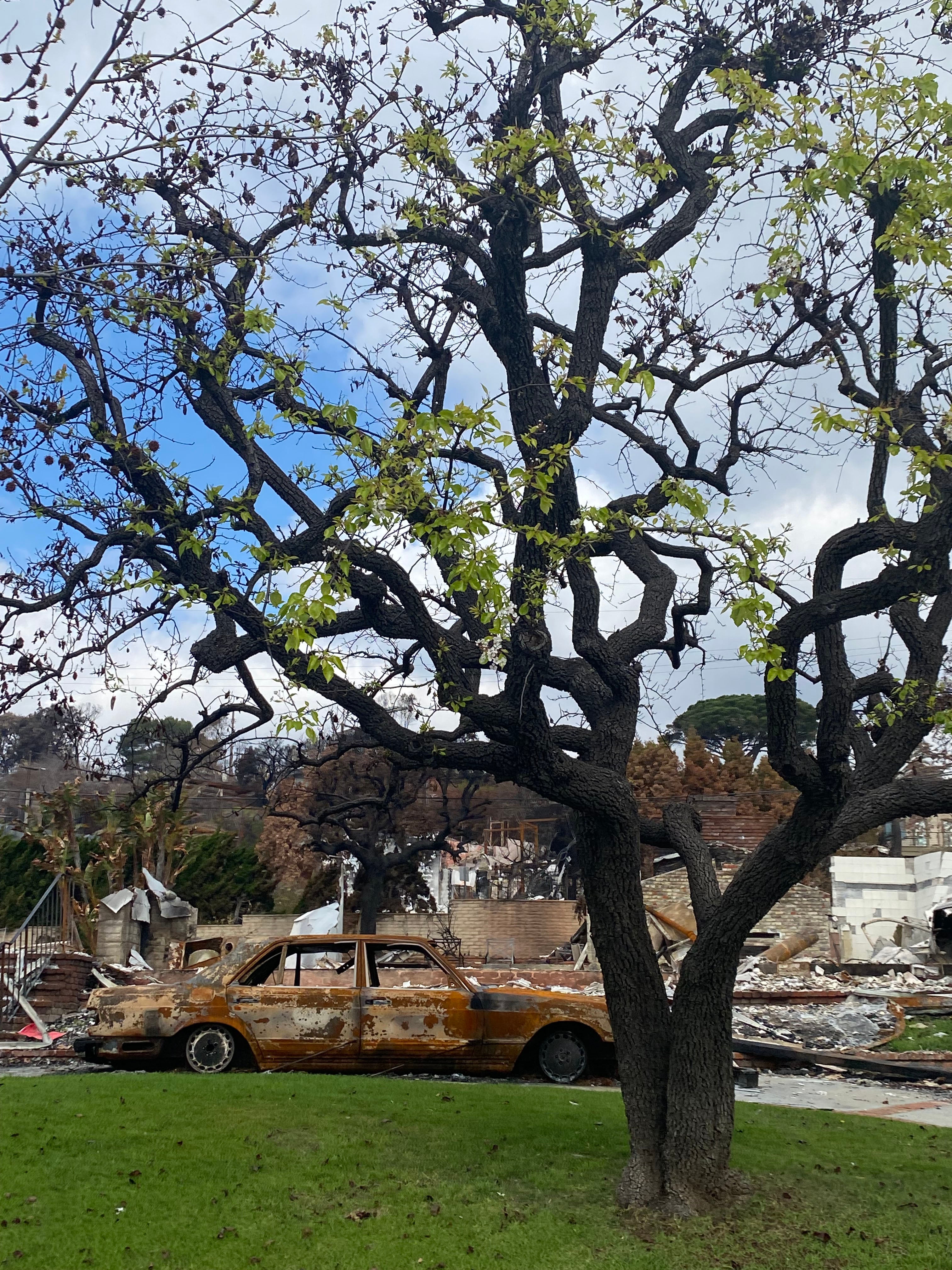
The team examined 15,082 structures and 52,893 tree canopies within the Eaton and Palisades fire scars and evaluated the relative associations of urban canopy and structure density with structure damage.
“Our study shows that during extreme urban firestorms, houses become the primary fuel source,” said Reed Kenny, a Cal Poly biological sciences lecturer and the study’s lead author. “Once fire enters a neighborhood, structure-to-structure spread matters far more than the presence of trees.”
“Urban trees and structure loss in the 2025 Eaton and Palisades fires,” which appeared in online format in April, is set to be published in print in the Urban Forestry & Urban Greening journal in July. The article was coauthored by a research team of scientists and faculty from Cal Poly and the San Luis Obispo-based Urban Forest Institute, a nonprofit organization that supports sustainable urban forest management through applied research, community outreach and practical tools.
The study examined two of the most destructive urban-interface fires in California history, representing areas where wildland vegetation merges with human development. Researchers combined CAL FIRE damage inspections, building footprint data, LiDAR (Light Detection and Ranging) mapping, satellite imagery and wind modeling to understand what factors most influence structure loss.
Their conclusion was clear: Houses packed closely together were far more likely to burn than homes in less dense neighborhoods.
Across both fires, each additional nearby structure per hectare significantly increased the probability of structure destruction. By comparison, the influence of tree canopy was small, inconsistent and, in some cases, associated with lower losses.
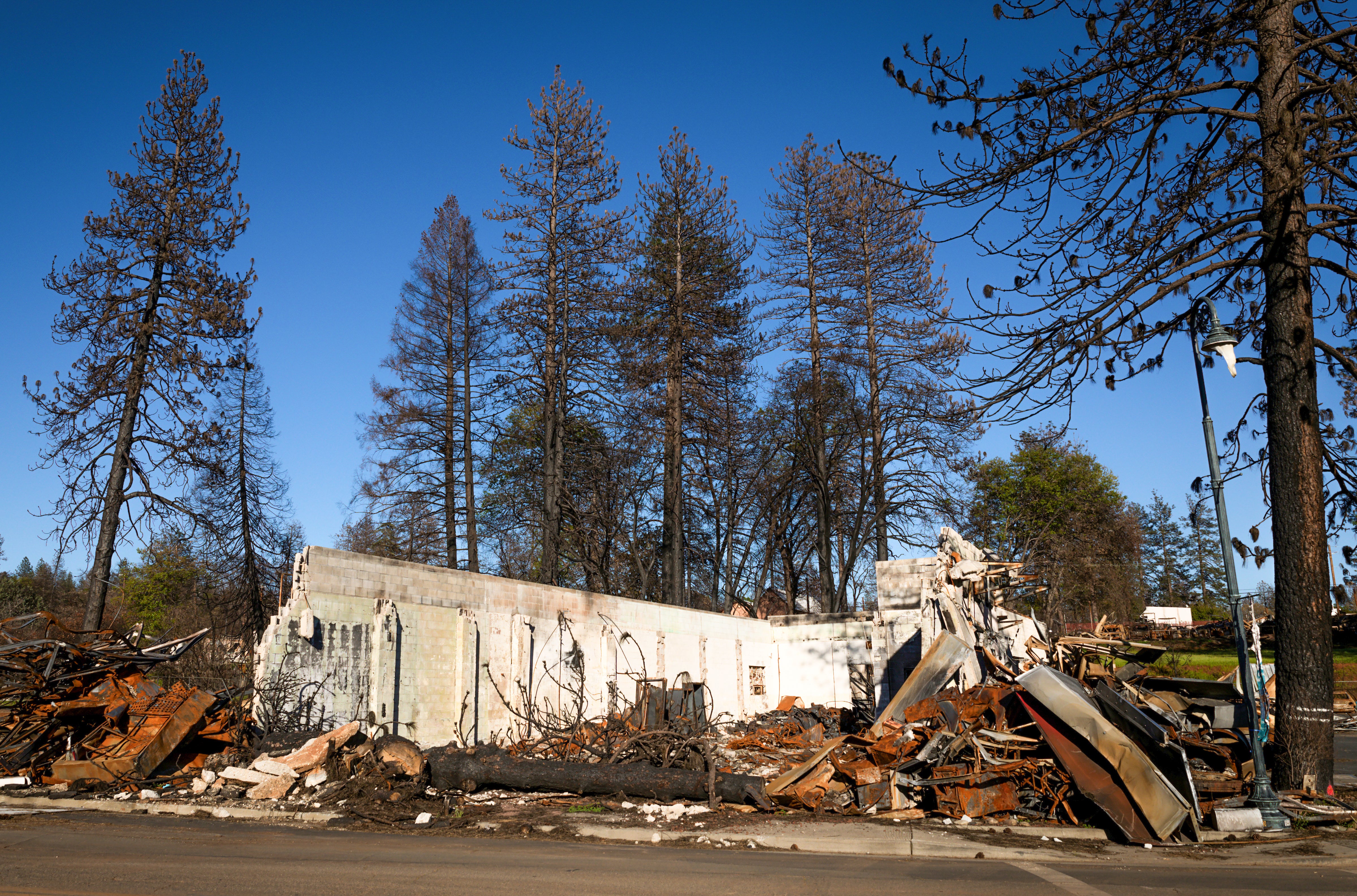
The Palisades and Eaton fires started Jan. 7, 2025, in Los Angeles County, centered on the Pacific Palisades neighborhood of Los Angeles, which burned the forested slopes between the cities of Santa Monica and Malibu, and the unincorporated community of Altadena.
Together, the wildfires killed 30 people and destroyed more than 16,000 homes and businesses, causing between $76 billion and $131 billion in losses.
Key findings include:
- Building density was the strongest predictor of home loss in both fires.
- Homes closer to neighboring buildings were more likely to be destroyed.
- Tree canopy effects were minor and contradictory between the two fires.
- Simulating removal of all tree canopy within two meters of homes produced only small reductions in predicted losses.
Why This Matters
California is implementing Zone Zero defensible space rules that may require an ember-resistant defensible zone through the removal of vegetation in the first 5 feet around a structure. The new study suggests policymakers should be cautious about removing valuable urban canopy without stronger evidence that trees are major drivers of home destruction in dense urban firestorms.
Urban trees provide shade, cooling, stormwater capture and cleaner air while offering public health benefits. The researchers argue that losing canopy at a large scale could create new environmental and human costs while doing relatively little to reduce losses in these types of fires.
Instead, the findings suggest communities may gain more protection by focusing on:
- Fire-resistant building materials
- Ember-resistant vents and roofs
- Increased spacing between structures, where possible
- Neighborhood-scale fire planning
- Maintenance practices such as pruning and leaf litter removal
A New Direction for Fire Safety
As wildfire disasters increasingly move from forests into suburbs and cities, this study reframes a critical question: Are trees the real problem, or are vulnerable building characteristics the larger risk?
The researchers conclude that future wildfire policy should prioritize home hardening and urban design, while carefully balancing the major benefits trees provide to communities.
Read an abstract of the research:
https://www.sciencedirect.com/science/article/abs/pii/S1618866726002104.
Top Photo:
A view of the Eaton Fire from Koreatown in Los Angeles in 2025. The Los Angeles County wildfire was a catastrophic event that burned over 14,000 acres in the San Gabriel Mountains and Altadena, destroying more than 9,400 homes and businesses and killing 19 people. It is ranked as the fifth deadliest and second most destructive wildfire in California history.
Photo by Jessica Christian on Unsplash


